I am here to help you explore the Great Ocean Road region, but I’m still learning and can make mistakes. For the best local advice, visit a visitor information centre. This is a large region, so plan for travel distances and your length of stay.
Hello
Hi! Let me help you plan your Great Ocean Road trip
Walking Trails of Mt Leura & Mt Sugarloaf Reserves
Climb volcanic peaks, the breathtaking views make the effort worthwhile.
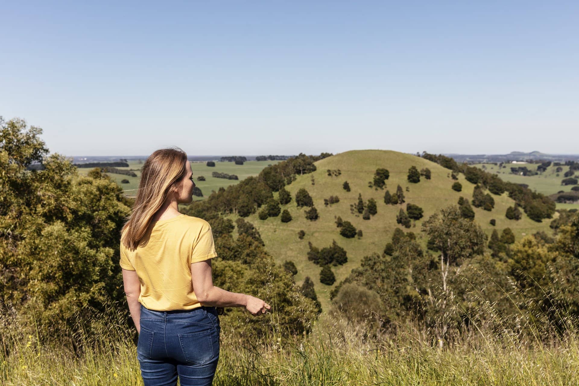
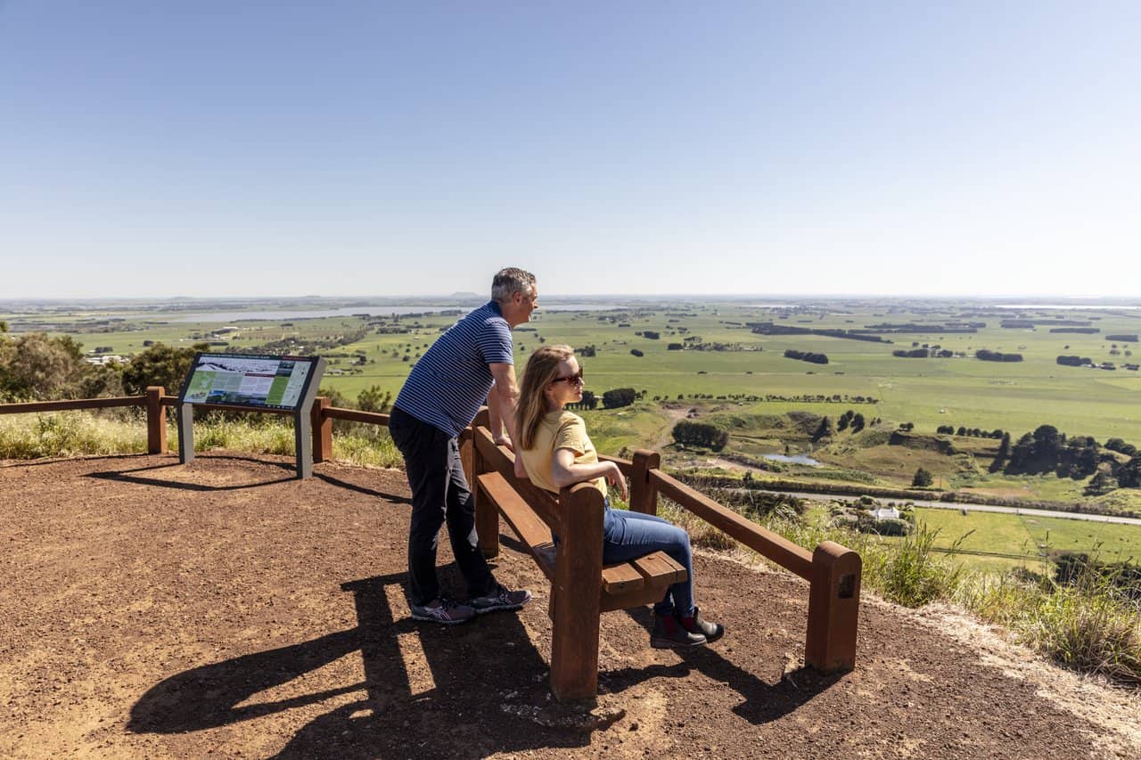
Mt. Leura and Mt. Sugarloaf Reserves provide stunning views of the surrounding landscape. You can see landmarks such as Camperdown's clocktower, Lake Purrumbete, and Mount Elephant. You might even see the Grampians National Park, located about 100 kilometres away or walk the 6km’s of well maintained trails.
Parking is available at the Lower Shelter or you can drive directly to the Mt. Leura lookout to take in the vistas.
Located to the east of the Crater Shelter, this short walk takes you to the perfect location to reflect on the diverse history of this landscape and its recent transformations. Enjoy the sounds of the reserves and reflect on its importance to indigenous Australians.
Maar Lookout Walk
One way | 80 metres | 2 mins | EASY
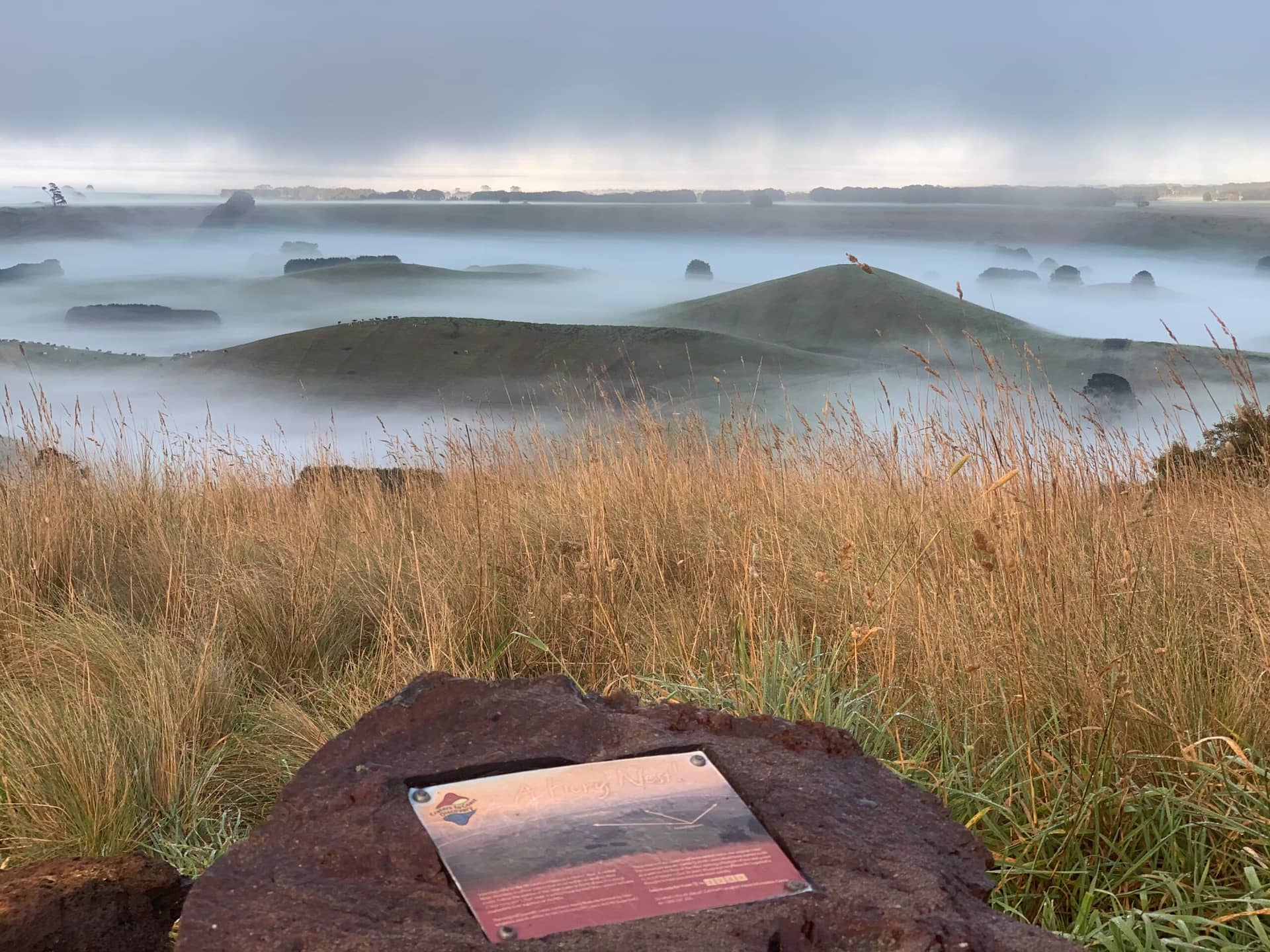
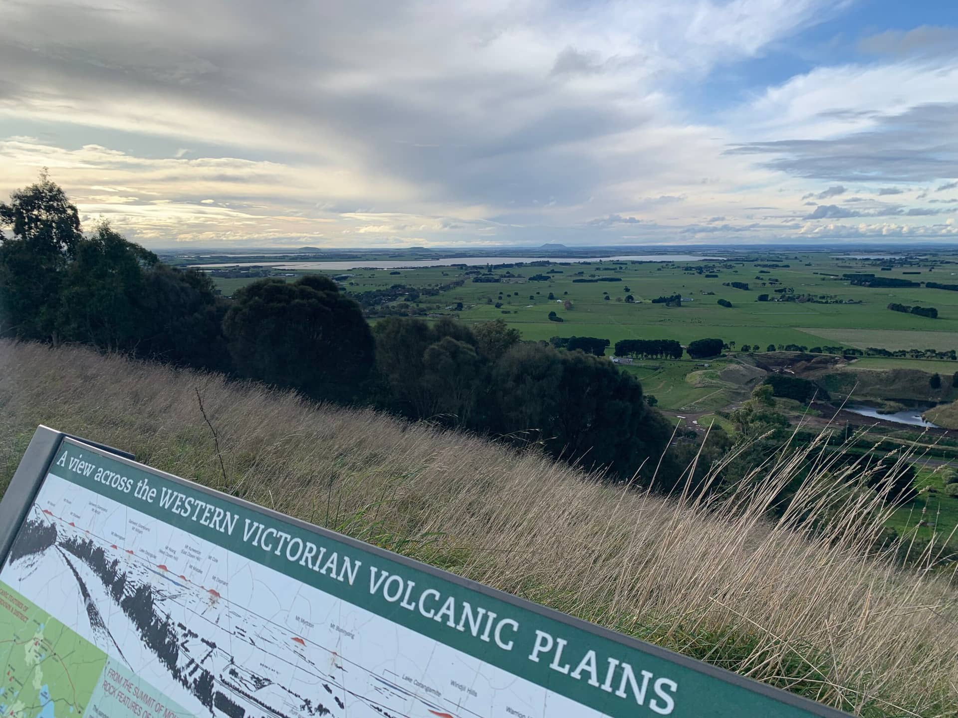
This is a significant section of the Volcanic Information Walk. Take advantage of the seat to enjoy the magnificent views over the Victorian Volcanic Plains: Lake Purrumbete and Mount Porndon to the east; the smaller scoria cones nested within the volcanic maar to the south; Mount Sugarloaf and the 100m deep crater to the west.
Crater Trail
One way | 375 metres | 7 mins | EASY to MODERATE
Experience what it is like at the bottom of this unique 100m deep crater and enjoy the solitude. The line of stones is the result of previous farm management. As you circle your way down keep your eyes and ears open for wallabies, kangaroos, birds, reptiles and koalas enjoying the seclusion and shelter.
Banksia Walk
One way | 300 metres | 10 mins | EASY some steps
This is a significant section of the Volcanology Information Walk. The Banksia marginata (Silver Banksia) trees are sourced from at least 10 remnant Victorian Volcanic Plains (VVP) provenances. This seed orchard will provide seed to reinstate this severely depleted species across the VVP.
Volcanology Information Walk
One way | 500 meters | 20 mins | EASY some steps
This walk includes seven information boards highlighting different aspects of the geology and volcanology within the two reserves and the surrounding volcanic plains.
Find out about volcanic bombs, crystals and tuff. As you walk this path reflect on the idea that for the past 40,000 years, indigenous people have also explored this volcanic landscape.
Lower Shelter Trail
One way | 650 metres | 15 mins | MODERATE to STEEP
A great place for a picnic, and to learn about volcanic history and revegetation of these reserves. The facilities at the start of this trail are major features of the Mt Leura and Mt Sugarloaf Reserves.
Starting as a grassy paddock, this area has changed significantly. The indigenous trees were planted as part of the 2000 Sydney Olympic Tree Planting Program. In 2002, the shelter was constructed from cypress milled on site. The stone wall was constructed in 2003. In 2007 work started on the local Volcanic Plains Wildflower Garden featuring approximately 30 different species with information labels. The Volcanic Education Centre was established in 2014. In 2020 the Hollows for Habitat Project began which involved manipulating hollows in trees for birds, mammals and reptiles.
NB: This trail offers access to all trails/walks on the reserves.
Southern Trail
One way | 650 metres | 15 mins | EASY to MODERATE
This walk takes you past the disused Mt Sugarloaf scoria quarry. Mt Sugarloaf was saved from destruction in a conservation battle which set a precedent at the time. In 1969, local people took direct action to save this natural landmark by sitting in front of a bulldozer. The National Trust acquired the land in 1971 to guarantee the preservation of the rest of the mount. The manna gums in the quarry are what remains of the 1970’s revegetation efforts to hide the quarry scar. From the safety of the walk track the exposed cliffs provide a unique glimpse of the underlying geology.
Lower Southern Trail
One way | 350 metres | 10 mins | EASY to MODERATE
The Lower Southern Trail offers and alternate route. This walk immerses you in the revegetation of the Reserves. Further on, the trail offers a secluded experience of the southern damper area of the reserves which includes glimpses of many smaller scoria cones, The trees in this area were planted on 2005; the native bracken fern has regenerated naturally.
Mt Sugarloaf Trail
One way | 1km | 15 mins | EASY to MODERATE
Before it was quarried, Mt Sugarloaf was considered the best example of a scoria cone in Western Victoria. Spiralling your way to the top offers spectacular 360-degree views of the Leura Maar Volcanic Complex. The track, as well as many others, were constructed by the previous landowner as part of his farm management program.
Panorama Circuit
Circuit | 1.7km | 45 mins | MODERATE
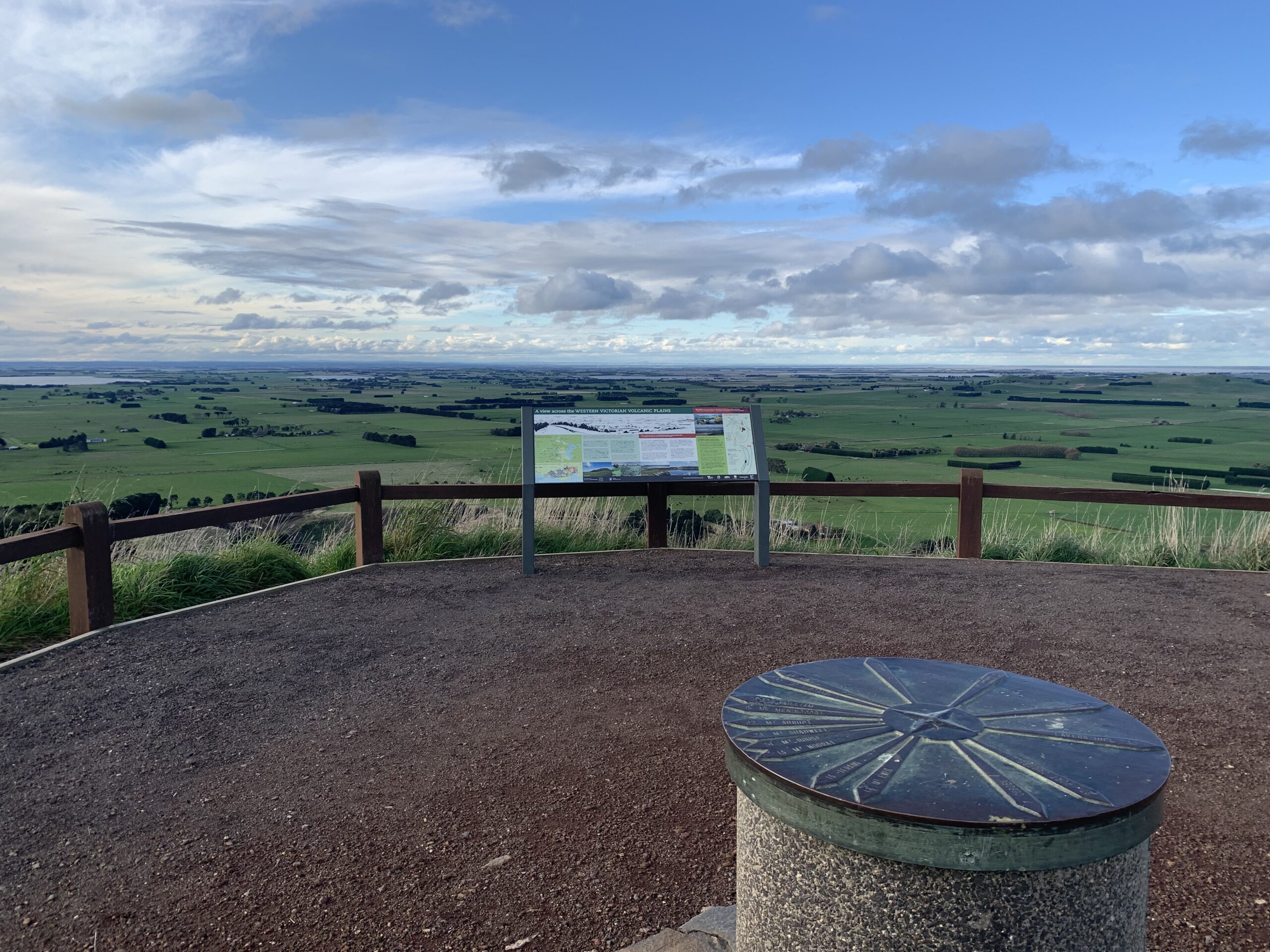
This walk offers a wide range of experiences, including views into the crater and across the maar; glimpses of the township and local lakes; and stunning views over the volcanic plains. Look out for a variety of wildlife, including birds of prey, koalas, wallabies and echidnas. A bird list is located on www.mtleura.org.au. Birds of prey are often seen soaring on the thermal updraughts created by the steep hillsides. Almost all trees you see have been grown at the Camperdown College community nursery and were planted between 1995 and 2007 by local, regional and international volunteers.
Have a rest at the ‘Crater shelter’, learn about the past 20 million years, and enjoy the intriguing sculpture of Mount Sugarloaf. The Panorama Circuit links with all the other walking trail within the reserves.